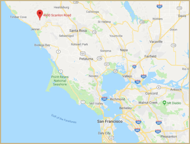
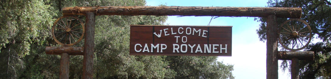
Royaneh
is
located
about
2.5
miles
south
of
the
town
of
Cazadero
in
Sonoma
County
on
the
Cazadero
Hwy.
Cazadero
is
a
small
town
with
a
population
of
around
420
folks
and
was
known
as
the
terminus
for
the
North
Pacific
Coast
narrow
gauge
railway
(1874-1931)
and
the
giant
Redwoods among other things.
Approximate distances and travel times to Camp Royaneh:
San Leandro, CA to Royaneh - 100 miles, 2.5 hours
Sacramento, CA to Royaneh - 130 miles, 2.5 hours
Eureka, CA to Royaneh - 230 miles, 4.5 hours
Fresno, CA to Royaneh - 265 miles, 4.5 hours
Los Angeles to Royaneh - 460 miles, 7.5 hours
Portland to Royaneh - 640 miles, 11 hours
Alaska to Royaneh - 3042 miles, 55 hours
Maine to Royaneh - 3369 miles, 49 hours
Alpha Centauri to Royaneh - 4.37 light years
Directions & Weather

Click on map for
Google directions
to Camp Royaneh

Copyright ©, All Rights Reserved
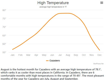
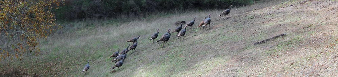
Royaneh is located approximately 18 miles from the Pacific Ocean and during the summer months the temperature has been known to reach
into the high 90’s and low 100’s. Cool afternoon breezes keep the camp cool and the shade of the Redwoods is very refreshing.
Royaneh Geo Statistics:
1
.
Country: United States
2
.
State: California
3
.
County: Sonoma
4
.
City: Cazadero
5
.
Zip Code: 95421
6
.
Longitude at Flag Pole: 123.063280 W
7
.
Latitude at Flag Pole: 38.519686 N
8
.
Elevation at Dining Hall: 341 feet
9
.
Elevation at Mountain Man: 532 feet
1
0
.
Timezone: Pacific Time
1
1
.
Topographical: Cazadero Quadrangle
1
2
.
Total Acreage of Camp: Appr 375
1
3
.
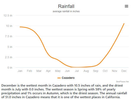
Average Precipitation: 36.17 inches
Weather in Cazadero